Bromo Tours from Malang: routes, best time to go, and how to prepare
Malang is one of the most convenient gateways to Mount Bromo. Learn the usual routes, how a typical visit unfolds from sunrise to the crater, when to go, and what to pack and prepare for.
Published September 29, 2026
Why start your Bromo trip from Malang
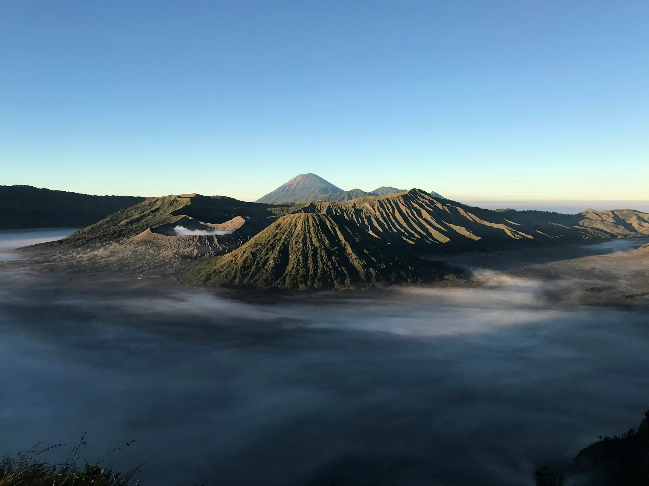
Mount Bromo sits inside Bromo Tengger Semeru National Park, which stretches across several regencies in East Java, including Malang Regency. That makes Malang a natural starting point, whether you fly into Abdul Rachman Saleh Airport, arrive by train at Malang Station, or already live in the Greater Malang area.
The big advantage of leaving from Malang is flexibility. You can go up the western side through Tumpang, or loop around to the northern side through Probolinggo and Sukapura. Both routes end up in the same caldera, but the journey, travel time and type of vehicle are different.
Two common routes: via Tumpang or via Sukapura
The Tumpang route is the one most often used from Malang city. Cars or coaches usually stop around Tumpang, where travellers switch to 4x4 jeeps built for the steep, winding and sandy roads up to Bromo. The road passes farmland and Tengger villages, and it is popular because the drive from the city centre is relatively short.
The Sukapura route, in Probolinggo, loops north along the intercity roads. It suits groups who want to stay the night before around Cemoro Lawang or Sukapura, which makes the early-morning run to the sunrise point much shorter. It is also the usual choice when Bromo is combined with destinations further east, such as the Ijen Crater in Banyuwangi.
Whichever route you take, the final stretch to the caldera and viewpoints is normally done by local jeep. Passenger limits per jeep, pick-up points and vehicle rules can change with park management policy, so always confirm them when booking.
- Via Tumpang: convenient from Malang city, straight into a jeep, good for trips without an overnight stay.
- Via Sukapura/Probolinggo: good if you stay near Bromo or continue on to Ijen.
- Both routes still depend on the weather and national park rules on the day.
The usual order: Penanjakan, the Sea of Sand and the crater
Bromo tours from Malang usually leave in the middle of the night, roughly between midnight and 2 a.m., so you reach a viewpoint before sunrise. The best known is Penanjakan, which looks over the Bromo caldera, Mount Batok and, on clear days, the summit of Semeru in the distance. There are other viewing hills too, used depending on crowds and road conditions.
After sunrise, the jeeps drive down to the Sea of Sand, a vast plain of volcanic sand on the caldera floor. From the parking area you walk or hire a horse to the foot of the stairs up to Bromo's crater. The climb will leave you short of breath, but from the rim you can see the steam and the crater walls up close.
Many tours also stop at the Whispering Sands and the green savanna often called Teletubbies Hill before heading back to Malang. Groups are usually back in the city by around midday, leaving time to rest or visit somewhere else.
Best time to go: dry season vs rainy season
Broadly speaking, the dry season in East Java runs through the middle of the year, roughly May to October. This is when you have the best chance of a clear sunrise and the sandy tracks are easier to drive. The trade-off is that pre-dawn temperatures can be very cold, and weekends and school holidays tend to be busy.
In the rainy season, roughly November to April, mist and cloud cover the view more often, tracks can be slippery or muddy, and rain can arrive at any time. On the other hand, the landscape is greener and there are fewer visitors. These seasonal patterns are general and can shift from year to year.
Keep in mind that the park authority sometimes closes the area or limits access, for example because of increased volcanic activity, extreme weather or Tengger ceremonies. Check official updates from the Bromo Tengger Semeru National Park office and the volcano status from PVMBG, Indonesia's volcanology agency, before you go.
What to wear and pack
The viewpoints before dawn are far colder than Malang city, and at the height of the dry season temperatures can drop close to freezing. Layers work much better than a single heavy jacket, because you can peel them off as the sun comes up and the air warms.
- A warm jacket or windbreaker, plus a long-sleeved base layer.
- A beanie, gloves, and a scarf or buff for your neck and face.
- Comfortable long trousers and closed shoes with a good grip.
- A mask or buff against volcanic dust, and sunglasses.
- A small torch or headlamp for walking in the dark, and a power bank.
- Drinking water, snacks, and some cash for small purchases on site.
Health and safety tips
Bromo lies above 2,000 metres and the day starts in the middle of the night. Little sleep, cold air and the steep crater stairs can be a lot for some people. Go to bed early before the trip, eat a proper meal and keep drinking water even when you do not feel thirsty.
Anyone with asthma, heart problems or high blood pressure, or who is pregnant, should check with a doctor first and bring their own medication. Volcanic gas and dust near the crater can irritate the lungs, so there is no need to push yourself to the rim if you are not feeling well.
- Follow your guide and park rangers, especially on safe limits around the crater.
- Do not climb over safety fences or sit on the crater edge for photos.
- Pack personal medication, a balm or muscle rub, and plasters for blisters.
- Keep children and older travellers close and give them extra time to rest.
Plan your Bromo trip with Bunga Wisata
Bunga Wisata is based in Karangploso, Malang, and can help you put together a Bromo trip, either as a group tour for offices, schools and communities or as a private tour for your family. We can help you choose the right route, arrange pick-up times, and combine Bromo with other destinations such as the Ijen Crater.
Send us your dates, group size and pick-up point on WhatsApp at +62 812-3390-9129. We will help you shape the plan around the latest conditions on the ground.